File:Taiwan Satellite Image.jpg

Original file (1,200 × 1,600 pixels, file size: 314 KB, MIME type: image/jpeg)
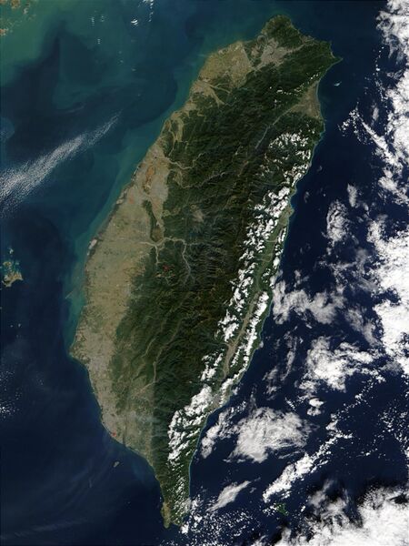
Satellite photo of Taiwan. Description by NASA: The island of Taiwan sits off of the coast of southern China between the East China Sea, the South China Sea, southwestern Japan's Nansei-shoto Islands, and the Pacific Ocean. The island is mostly mountainous in the east, but gradually transitions to gently sloping plains in the west. At the northern tip of the island is Taiwan's capital city, Taipei, which appears as a large grayish patch surrounded by dark green. In this image, most of Taiwan's eastern coast is dotted with low clouds, with low and high clouds off the coast in the Pacific Ocean. MODIS also detected three fires, which are marked in red. This true-color Terra MODIS was acquired December 15, 2002.
File history
Click on a date/time to view the file as it appeared at that time.
| Date/Time | Thumbnail | Dimensions | User | Comment | |
|---|---|---|---|---|---|
| current | 15:24, 16 August 2013 |  | 1,200 × 1,600 (314 KB) | Judge King (talk | contribs) | Satellite photo of Taiwan. Description by NASA: The island of Taiwan sits off of the coast of southern China between the East China Sea, the South China Sea, southwestern Japan's Nansei-shoto Islands, and the Pacific Ocean. The island is mostly mountai... |
You cannot overwrite this file.
File usage
The following page uses this file: